GIS For Good® in St. Louis, Missouri
At RomoGIS we work alongside residents, schools, and grassroots groups to turn local knowledge into action. From neighborhood surveys to StoryMaps, we’re building tools that reflect the real St. Louis — and helping communities shape what comes next. Whether it's using maps, drones and community-led data we do our best to help the community out. We also use GIS to support emergency management and support services for communities.

GIS For Good®: Emergency Management
In North St. Louis, our GIS For Good® program supported disaster recovery after a devastating tornado. As a quick response, we collaborated with LOVE the LOU to train students to use drone technology and digital mapping tools in order to better meet community needs, perform damage assessments, and support local recovery efforts. Layering emergency data with community knowledge highlighted both where physical destruction occurred and where populations were at heightened risk. This helped decision-makers allocate food, medical supplies, and temporary housing in ways that were both efficient and effective. By elevating local knowledge alongside technical mapping, the project reinforces RomoGIS’s GIS For Good® aim of using maps to improve lives, strengthen neighborhoods and create a safer, more resilient future.

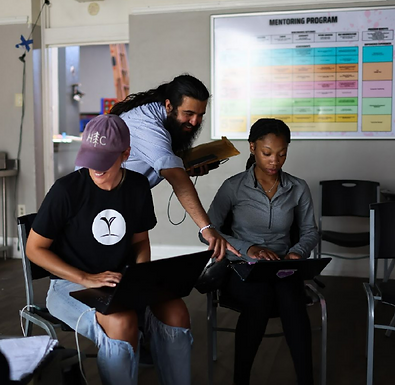
This summer, we trained over 100 local learners on how to use urban planning tools along with GIS and drone technologies to create solutions for rebuilding the neighborhood. Through this process, high school students stepped into leadership roles, guiding younger peers through mapping activities, while elders tried drone flight for the first time. This intergenerational exchange reflected the heart of our GIS For Good® Movement, which is bringing people together across age and experience to learn, teach, and build capacity for community-led change.

Through our continued partnership with LOVE the LOU, we are equipping more people with the skills to document their own expertise, leverage spatial data, and create powerful maps that drive neighborhood transformation and create long-term impact. By participating in our GIS For Good® training programs, local St. Louis community leaders like Terrance Williams developed in-demand professional skills that can expand their future employment opportunities and can position them to assist in securing funding for the community’s rebuilding efforts.

Our GIS For Good® Movement continues to grow in its impact on workforce development, community leadership, and disaster recovery efforts in St. Louis. We are thankful for our partnership with LOVE the LOU and community leaders that make this work possible, including Brian Monheiser and Kim Plank . Our East Los Angeles Community College intern Jonnie Robles also contributed significantly to this GIS For Good® initiative and led a poster presentation at the 2025 Esri User Conference to share our work. To learn more about our GIS For Good® in Action programs in St. Louis, check out our StoryMap .